Ben Bhreac in Winter and Summer
|
Back to home page
|
On 11 February 2008, we went about half way up the west shore of Loch Lomond, and parked less than a half mile westward up into Glen Douglas. The initial portion of the walk was up through rough grass grazed by cattle and sheep.
Below are some pictures with a narrative beside each one. Click on an image below to see a larger version of the picture. When viewing a larger picture, clicking "Next" allows you to look at the larger pictures one at a time.
|

|
This picture is the first good view to the northeast. Ben Lomond is on the other side of Loch Lomond, about three miles away. The water level of the loch is less than 50 feet above sea level, and the top of Ben Lomond is almost 3200 feet above sea level. Since it is not summer, most of the hills are brown. The lower slope is planted forest for future timber. The upper slopes are mostly rough hill grasses and rocks with some heather. Though Ben Lomond is a national park, the entire hill is used for grazing sheep in limited quantities.
The road along the west shore of the Loch is visible. Because of the steepness of the hillside, there isn't a road along the eastern shore, just the West Highland Way walking path.
|
|

|
While crossing the fairly flat area, we were on a small ridge when I noticed that the low angle of the winter sun, caused our shadows to be projected onto the moorland grass, with Ben Lomond in the distance.
|
|

|
Off to the west we spotted about seven deer. None of them seemed to have antlers but we couldn't be sure at that distance. They saw us and started moving away. Some of them paused to look back at us at this point where they were quite visible against the sky. They were perhaps a half mile away from us. Though we have walked in the hills many times, this is only the second time we have seen deer. However, this is the first time we have walked Ben Bhreac.
|
|

|
As we climbed the second portion of Ben Bhreac, we noticed these two deer looking down the hill toward us. They were about 100 yards away. After I snapped a couple of photos and started walking on up the hill, they quickly moved off out of sight.
|
|
|
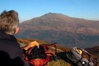
We sat on a rocky outcrop for sandwiches.
|
|

|
While ascending we sometimes followed paths made by sheep but we didn't see any evidence of people. But on top of the ridge there was a human path leading between the various peaks. The highest peak has a concrete survey marker. The white rocks in the foreground are quartz.
|
|

|
The altitude of the highest peak of Ben Bhreac is 2236 feet and we had left the car at an altitude of about 300 feet. This picture is looking northwest toward the "Arrochar Alps", the informal name for that distant cluster of hills, each about 3000 feet high. |
|

|
While descending, from the brow of a grassy knob we spotted three deer grazing about a hundred yards ahead of us. By the time I got my camera ready they were moving off.
|
|

|
The sun was behind the hills to the southwest as we descended into the glen.
|
|

|
In the summer, 13 August 2008, on the same hill, I took quite a few photos of heather in bloom along the side facing Loch Lomond and Ben Lomond on the other side of the Loch. Several of those pictures are in the Heather of 2008 photo album.
This picture is looking back down the slope at the blooming heather, as I'm ascending the upper slope of Ben Bhreac.
|
|

|
While walking I stopped to eat blueberries occasionally. They aren't easy to photograph because the berries are under the leaves, and they are mostly small plants living in the protection of heather and grass. I ate this berry and several others nearby after snapping this picture.
|
|

|
From the top of the ridge, this is the view to the southwest, looking at the upper portion of Glen Douglas.
My guess is that the regular shapes among the trees are, nuclear warhead storage bunkers. It has been publicly known for 40 years or more that British nuclear submarines are based at Faslane on Gare Loch, about six miles south-southwest of those bunkers.
The official British Ordnance Survey maps show the roads that interconnect the bunkers inside a fenced area, but it does not label the facility. There also seem to be railway sidings within the facility that connect with the adjacent West Highland Railway line (from Glasgow to Fort William and Oban).
The satellite photos on Google Earth show the same things seen on the map and in this picture. The satellite photos also show two submarines at the Faslane dock, plus other naval ships nearby. They also show several railway vehicles within the fenced facility seen in this photo. However, I don't see a railway connection at the Faslane site, so perhaps the railway use was mostly in an earlier era.
To see either the map or the satellite images, look a few miles south of Arrochar.
|
|

|
This is the survey marker on the highest rock on Ben Bhreac. The following four pictures were taken from the top of the concrete pillar.
|
|

|
This view is looking southeast at the southern portion of Loch Lomond. If the weather were clearer, portions of Glasgow would be visible on the horizon. In August the hill sure looks better in green than the brown of February.
|
|

|
This view is looking east at Ben Lomond. In this picture Ben Lomond is mostly in the sunshine, except for a few cloud shadows.
|
|

|
This view is looking north at the upper portion of Loch Lomond. Some of the many Highland hills can be seen on the horizon.
|
|

|
This view is looking along the ridge to the northwest. The hill near the left of this picture, with the distinctive notched top, is Ben Arthur, colloquially known as The Cobbler. The distant hill in the center of this picture is Ben Ime and the one on the right is Ben Narnain.
|
|

|
I walked by myself that day, so the camera is sitting on a rock in timer mode for this picture. I'm not wearing a jacket because it's frigid in August. I was wearing thin shorts and a t-shirt. In the breeze at the top of the ridge, I should have put on a sweatshirt or fleece, but my jacket was the top item in my backpack so that's what I put on.
|
|

|
That's an airplane flying down Glen Douglas, far below where I'm walking on the hill. It is a small float plane based at Inverbeg at the mouth of Glen Douglas. When this picture was taken it was coming in to land on Loch Lomond. I had seen it flying several times that day, taking tourists sightseeing I assume.
|
|

|
This was my first time to go hillwalking in several months, so my fitness wasn't very good. By the time I got back to the brow of the descent back down into Glen Douglas, my feet were tired. Looking down it seemed to be a long way to the car which was parked in that wide spot in the Glen Douglas single-track road that is visible at the center of this picture. But eventually my sore feet got me down that slope.
|
|
|
|
Back to home page
|