Scenery of the Cornish Coast
|
Back to home page
|
The long peninsula of Britain that extends southwest out into the North Atlantic Ocean includes several counties. The one at the end is Cornwall. Some Cornish people feel they should be considered a separate culture and country like Wales and Scotland.
The coast of Cornwall has, arguably, the best coastal scenery I've ever seen. The sea, surf, rocks, coves, beaches, cliffs, green grass above the cliffs and wildflowers all provide wonderful colors. Plus, there is a grassy public walking path along the top of the cliffs and down across each cove.
Below are some pictures with a narrative beside each one. Click on an image below to see a larger version of the picture. When viewing a larger picture, clicking "Next" allows you to look at the larger pictures one at a time.
|
|
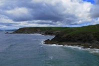
On the south coast of Cornwall, the Lizard Peninsula extends the furthest south of anywhere in Britain. We spent a day walking along the western coast of the Lizard Peninsula.
This view is looking north from Poldhu Point. There are about seven surfers in the water off of Poldhu Cove. To me they look cold in their wet suits waiting for a wave.
|
|

|
The monument is dedicated to Marconi, who sent the first radio messages from Europe to North America from this spot in 1901. He built similar transmitter/receiver sites in Nova Scotia and on Cape Cod.
|
|

|
A mile or so to the south this view is looking north back toward Poldhu Point.
|
|

|
There is a small but solidly built harbor along the rocky coast, at Mullion Cove.
|
|

|
Wildflowers along the cliff top with Mullion Island off shore.
|
|

|
The swirling of North Atlantic waves on the rocks below the cliff with a carpet of wildflowers in the foreground.
It was mid-June 2007 when we were there. It looks like the wildflowers would have been far more colorful several weeks or perhaps a month earlier.
|
|

|
A lunch room with a view! There was some sunshine when this picture was snapped.
|
|
|
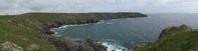
This panoramic image is made by software that has stitched together five snapshots.
This image is from near out lunch spot, but unfortunately the sun wasn't shining at this moment.
|
|

|
This picture was taken a half hour later, looking back toward where we had lunch.
I really enjoyed the contrast of the peaceful flat grassy fields with wildflowers and the rugged cliffs and surf below.
|
|

|
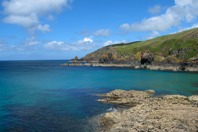
There wasn't enough time to walk to that next headland. This is arguably the best photo of the day -- with the blue sea, white waves, dark rocks and green grass above.
|
|

|
Walking in the delightful field. At this point we have started the return walk along the route we had come.
|
|

|
This is a panoramic image of five photos showing the coastline back to where we had left the car.
|
|
|
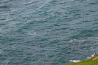
There were a couple of large basking sharks cruising near the rocks in the sea below. They seemed to be about ten feet long. Basking sharks, I learned after seeing them here, eat only plankton. They are like whales, not a danger to people. Apparently they swim along with their mouth wide open taking in food. They are apparently fairly common, at certain times of the year, along the Cornish coast.
At the center of this picture is the fin of a shark, plus a bird flying close to the water. If I remember right, the other shark is to the left of the center of this picture. On the left edge of this picture is a float for a lobster trap, with a small Cornish flag (black with a white cross).
I don't know whether the popular image of a black and white pirate flag has any connection to the traditional flag of Cornwall -- but it might. There is the play "The Pirates of Penzance" and the harbor of Penzance is only 15 miles along the coast from where this picture was snapped. For centuries the Cornish have been well known for plundering ships that have wrecked on the rocky coast. So it seems possible that the black and white skull-and-crossed-bones pirate flag has a Cornish origin. |
|

|
The green grass along the top with the sea and rocks below make it a beautiful place to walk.
|
|

|
The photos that have been stitched together to make this panoramic image were snapped several hours later, not long before sunset.
We had dinner in a hotel near the coastal walking path. They seemed happy to serve us even though we came into their dining room carrying backpacks and wearing hiking boots. My memory isn't certain, but I believe we ate in the hotel visible near the upper left of this picture.
|
|

|
A few days later we walked along the west coast of Cornwall, about ten miles northeast of Land's End (the most western point of mainland Britain -- there are some fairly small islands further west). We left the car at a hotel and walked through the small village of Treen and down through the fields to the rocky headland called Gurnard's Head.
This view is looking southwest toward Land's End, though that distant headland isn't Land's End -- it's called Pendeen Watch and is four miles away.
|
|

|
Looking the other way, this is the view into Treen Cove.
We had done several other things that morning, so it was time for a lunch. It was a fine place to sit beside the path with the sun on our back and look out upon the scenic cove.
|
|

|
After lunch we walking along the cliff top. Near the center of the cove we passed a mine shaft. We walked down a track to the walls of what had once been a building for processing the mined ore.
I left my backpack beside the building and climbed down the rocks toward the water. This picture is looking back toward Gurnard's Head where we had lunch.
|
|
|
This view is looking the other way toward the next set of headlands, to the northeast.
|
|

|
Standing on a rock, 11 photographs were snapped looking in all directions. The software that stitches the photos together is far from perfect. The imperfections at the transition between one photo and the next can be seen, particularly on the horizon line looking out to sea. It seems like the round camera lens causes a lot of the distortion when trying to make a flat two-dimensional image from multiple photos. But even with the limitations, the panoramic image provides a hint of what it was like to be there with scenery in all directions.
The left end of the panoramic image shows the walls of what was once a tin mining building. The mine shaft is in the brush between the mine building and the modern house. From left to right the panoramic image shows what is seen in every direction around to seeing the same ore processing building ruin at the right end of this image.
|
|

|
Then scrambling over the rocks there was this mine shaft opening at the water line. The mine extended down to the level of the sea. The opening at sea level provided ventilation to the mine. Some of the mines extended far below sea level, but evidently this one did not.
|
|

|
I couldn't get enough of the colors. This view is from the level grass beside the wall of the abandoned mine building. Unfortunately the wildflowers are far past their colorful best.
|
|

|
We walked on along the grassy path. This is the view from the next headland.
|
|

|
The sand bottom in this cove provides the lighter aqua color of the sea.
|
|

|
We thought it best to not continue to the end of Zennor Head, so that we had enough time to get back.
This view, with some blooming heather in the foreground, is back along the route we have followed, with Gurnard's Head in the distance.
|
|

|
This view is along the path as we were returning to the car.
When we got back to the old mine, we took the shorter route back up to the village of Treen. After getting out of our hiking boots at the car, we had dinner in the hotel restaurant.
|
|

|
A few days later we walked along the north coast of Cornwall. We left the car at Treyarnon Bay, west to Padstow. With more sunshine, the colors were even better than the previous coast walks, even with the wildflowers continuing to fade in color.
|
|

|
I like colorful seascapes!
|
|

|
After the first headland, Treyarnon Point, there is a fairly long beach at Constantine Bay, the far end of which can be seen on the right side of this picture.
|
|

|
Beyond the beach the coastal path, seen here in the foreground, is in a broad grassy field beside the rocky shoreline. The path gently climbs as it approaches the headland, called Dinas Head.
|
|

|
I enjoy the variations of the color of the sea. In the distance, beyond the headland, is a rock that must have been a hazard for ships at night and in foggy conditions before radar was available.
At the base of the cliff where I was standing to take this photo, the sea has eroded a soft section of the rocks into a tunnel 100 to 200 feet long.
|
|

|
Then a portion of the roof of that tunnel collapsed. This is the large hole in the ground that opened up. Those are waves and sand down at the bottom of the hole.
Presumably sometime in the future the rest of the tunnel will collapse too. With many winter storms over many many years, the sea is slowly eroding away the shore. Very slowly, Britian is becoming a smaller island.
|
|

|
We had lunch on the seaward side of the top of Dinas Head.
|
|

|
The lighthouse is on the next headland, Trevose Head. Note the boat just beyond the rocks. It seemed to be collecting lobsters from traps on the sea floor.
|
|

|
With wildflowers in the foreground, this view is looking east across several bays.
|
|

|
Wildflowers beside the walking path.
|
|

|
This view is from beside the beach in Polventon Bay (also called Morther Ivey's Bay).
The aqua-colored background of this web page is a photo looking down at the shallow water near this beach.
|
|

|
This sea gull was standing at the edge of the cliff, facing into the wind, ready to soar off.
|
|

|
This is a different gull, I believe. There were several of them gliding effortlessly on the updraft of the wind hitting the face of the cliff.
We returned to the car along the same route.
|
|

|
Not all of our days in Cornwall were dry with blue skies. Some were quite rainy. On one of the rainy days we visited the telegraph museum at Porthcurno. This was the hub of the undersea telegraph network that connected Britain with telegraph offices around the world.
It seems safe to call it the Victorian Internet. In the late-1800s people could send text messages from London (and numerous other British cities) to people in North America, continental Europe, some places in Africa, India, Singapore, Hong Kong, Australia, and New Zealand. Britain didn't have telegraph access to South America until World War I when they cut a German cable and took the severed end to Porthcurno, and thereafter for many decades had cable access to several South American cities.
Porthcurno was also the training center for the operations and maintenance people sent to telegraph stations around the world.
|
|

|
The communications medium was a heavy gauge copper wire, well insulated, with an outer case of steel wire for strength. The text was sent as Morse Code.
In the 1890s the sending and receiving of Morse messages was done be human operators at each end of a cable. In order to get messages to the other side of the world, they were resent by the operators at relay stations every few thousand miles.
By the 1920s the the relay stations were somewhat automated, using equipment such as shown in these pictures. That automation was long before computers or any other form of electronics. The automation was all mechanical, driven by electric motors.
Messages were automatically forwarded to the next relay station based on the destination code in the header of each message, the same as internet servers do with email messages today. Relay stations punched a paper tape of each message. Those are the white tapes visible in these pictures dangling from machines and on reels. If a message wasn't fully received at the destination it could be resent from the paper tape. Apparently the resend was not automated in the 1920s, as it is today with email.
|
|

|
The day we were at the telegraph museum, there were two white-haired chaps who, with good glasses and strong light, still know how to operate, adjust and oil the machines.
They demonstrated creating a message with a typewriter-style keyboard that punched a paper tape of the Morse Code message. They then showed sending that message and receiving that message with the equipment on the other side of the room.
The two long rooms of the museum are tunnels dug into a solid granite hill by Cornish miners during the early months of World War II so that the hub of Britain's vital world wide communications network was not vulnerable to Nazi bombing aircraft.
I found the telegraph museum enlightening, and amusing in that people are so prone to think that email is a wonderful new technology. As with virtually all inventions, email is the result of upgrading earlier technologies. I believe armies have sent messages by waving flags and flashing lights for a very long time. Sending telegraph messages by wire was developed in the early 1800s. I learned in Porthcurno that messages were sent via Atlantic cable by the 1870s. The worldwide cable network was automated by the 1920s. I'm not yet sure when the teleprinter networks became worldwide, but I suspect that was in place by the mid-1900s. By 1980 I believe there were a variety of typed message networks, only one of which was the internet.
And we still use cables lying on the bottom of the oceans of the world, as they did 130 years ago. The only difference is the message capacity is far greater with fiber-optic bundles than with one copper wire.
|
|
|
|
Back to home page
|