| <-- Previous | ^ Up ^ | Next --> |
|
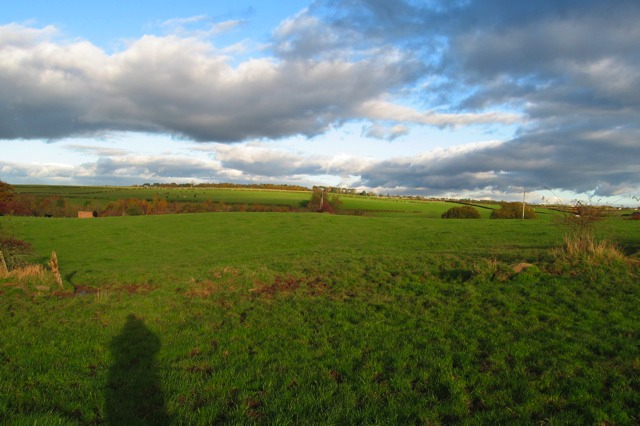
Several hundred yards further to the north-northeast, the route seems to turn in the flat featureless field just behind where this picture was taken. The route seems to then go east-northeast, along the north side of a field boundary that goes straight for over a half mile, on a map bearing of 61°, which is straight ahead in the center of this picture. There is another interesting thing about this picture. About 20 feet in front of the photographer there is a cross fence. There is now a gap in that fence, as seen in this picture, to allow modern farm equipment to go between the two fields. At both the left and right edge of this picture there is a pile of stones. There are no stones seen anywhere else along that fence. One wonders if Roman bottoming stones were in recent decades dug out of the low spots along the cross fence line and put aside out of the way. |