|
|

|
Driving west from the prairie city of Calgary, one sees a continuous chain of mountains on the horizon. |
|
|

|
Banff National Park begins about an hour west of Calgary, Alberta, and extends for over a hundred miles along the Continental Divide. |
|
|

|
On our first day in Banff National Park we walked up Johnston Canyon. |
|
|

|
Clean water rushing down the canyon. |
|
|

|
With countless waterfalls. |
|
|

|
Someone offered to take our picture. |
|
|

|
One of the higher waterfalls. |
|
|

|
This is the same waterfall from upstream. |
|
|

|
In places the walking path is hung from the wall of the canyon. |
|
|

|
An idyllic waterfall. |
|
|

|
Another beautiful waterfall scene. |
|
|

|
A waterfall with a rainbow in the mist. |
|
|

|
A quiet clearing for lunch. |
|
|

|
From our lunch spot looking through the trees to Copper Mountain, about four miles away to the south. |
|
|

|
A view of Mount Ishbel, about two and a half miles to the east, on the other side of Johnston Creek. |
|
|

|
Looking back at Mount Ishbel, about two and a half miles to the southeast. |
|
|

|
There are springs bubbling up through the sand at the bottom of the shallow ponds. They are apparently called Ink Pots because each spring supposedly has a different color. Maybe it was the cloud cover, but we didn't see a difference in color. |
|
|

|
From the Ink Pot ponds this is the view looking up the valley toward the mountains to the north. At this point we descended back to the car. We walked 9.6 miles and climbed 1250 feet. |
|
|

|
Because the evenings are long in June, we drove up the old highway and came upon this male elk grazing close to the road. |
|
|

|
Looking northwest from Tunnel Mountain Road, on the edge of the town of Banff, at Cascade Mountain, which is about three miles away. |
|
|

|
This is our first view of Mount Inglismaldie from near where we left the car, near the mouth of Stewart Canyon. |
|
|

|
Looking eastward, up Lake Minnewanka. The distant peak on the left is Mount Costigan, which is ten miles away. |
|
|

|
We walked on an excellent hiking path along the north shore of Lake Minnewanka. This view is looking eastward at Mount Inglismaldie from the mouth of Stewart Canyon. |
|
|

|
There were delightful pale blue butterflies. They were small, perhaps an inch from wing-tip to wing-tip. It wasn't easy to get a photograph. This one landed in the middle of the path and I was able to snap a photo before it flew away. |
|
|

|
From the east bank of the mouth of Stewart Canyon, this view is looking westward at the Cascade Mountain range. |
|
|

|
Mount Inglismaldie is about two miles southeast of this vantage point along the Lake Minnewanka Trail. |
|
|

|
The aqua color of the water is amazing. We learned later that the color is partially due to dust ground so fine by glaciers that some of it remains suspended in the water. Not all of the glacial dust sinks to the bottom of the lakes. |
|
|

|
There are so many beautiful angles of the same scenery. |
|
|

|
This view is looking southward at Mount Rundle, which is eight miles away. |
|
|

|
It is fun to watch how the puffy white clouds change the view across the lake. |
|
|

|
The view eastward up the lake toward Mount Costigan. |
|
|

|
Countless different views! |
|
|

|
Mount Rundle down the lake to the south. |
|
|

|
The path eastward. Mount Costigan is dropping from view behind the nearer ridge. This image has a fine range of colors. |
|
|

|
We had lunch and voted against the 1800-foot climb to Aylmer Lookout. We had gone far enough, it was time to head back. This view is looking southeast at mountains we hadn't seen until now. The tour boat had been going up and down the lake all day. |
|
|

|
A more zoomed view of the mountains near the top of the lake. They are off the edge of the map we have so we don't know the name of those mountains. |
|
|

|
This view is toward the southwest from the pebble beach where we had lunch. The mountains in the distance must be beyond the town of Banff, about 25 miles away. |
|
|

|
While walking back this deer appeared between the path and the lake. |
|
|

|
We assume the short horns means he is a yearling male. |
|
|

|
He lifted his head from grazing to look at me 30 to 40 feet away. |
|
|

|
He was evidently unperturbed by me. He continued his slow pace across the path. |
|
|

|
He stopped to graze a bit more. |
|
|

|
Then he meandered on up the hill. |
|
|

|
And we continued our equally slow pace back toward the car. |
|
|

|
I couldn't get enough pictures of the variations of colors on the lake, sky and Mount Inglismaldie. |
|
|

|
And Mount Rundle as well. |
|
|

|
This puzzled me. Looking down from the path there was a substantial stream flowing into the lake but the path we were walking did not cross a stream. I wanted to go down and see where the water was coming from, but the slope was too steep here. So I went back a few hundred feet to a place where I could slowly descend over boulders to the shore. |
|
|

|
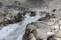
The stream was just gushing out of the rocks! |
|
|
|
I have seen springs before, but never one that produced so much water. This stream is about five feet wide. |
|
|

|
With the sun more to the west, the view of Mount Inglismaldie is different. |
|
|

|
Endless views. |
|
|

|
An early evening view of Mount Rundle. The GPS receiver said we walked 14.9 miles that day, but since it was a lake-shore walk there was little climbing. |
|
|

|
It looks like Lake Minnewanka is probably a natural lake that has been enlarged by the dam on the right in this picture. I suppose it is part of the Calgary water supply. |
|
|

|
A view of Mount Rundle looking south across Two Jack Lake. From here the mountain is about six miles away. |
|
|

|
Driving back toward town we came upon two female elk and this big buck. But he wasn't in a photographic setting beside a road construction storage yard. |
|
|

|
Not many towns have a mountain that big at the end of the street. That is Cascade Mountain and it is four miles away, which shows how big it is. |
|
|

|
We drove over Vermilion Pass on highway 93 and down to the Columbia River Valley. |
|
|

|
Surprisingly for us, the Columbia River flows northwestward here, before it flows around the range of mountains and then southward to Spokane and Oregon. |
|
|

|
We drove northwest, down the Columbia River Valley with a chain of mountains to the west and the Rocky Mountains to the east. It is a beautiful lush valley. |
|
|

|
We wonder if there are hiking and scenic photographic opportunities in those mountains. That chain of mountains is separating the north flowing and the south flowing portions of the Columbia River. The map we have doesn't give that chain of mountains a name. |
|
|

|
Between the highway and the railroad, beside the power lines is this eagle's nest. The white spot in the center of the nest is the head of the eagle, presumably sitting on eggs. The nest site overlooks the shallow ponds along the river, which is perhaps a good feeding area for the eagles. |
|
|

|
As we returned to Banff via the Trans-Canada Highway, we passed this freight train, with Cathedral Mountain behind it. The train has nearly reached the summit in it's pull up 2700 feet of altitude from the Columbia River. |
|
|
|
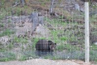
The fence is high and sturdy to keep bears off of the Trans-Canada Highway. This bear was eating dandelions that grow better in the sunshine of the cleared land along the highway. He seemed to be wishing he could get over or under the fence, because there were a lot more dandelions on the other side. |
|
|

|
This is fine scenery, but I can't remember where the photo was snapped. |
|
|

|
From the Rockpile beside the mouth of Maraine Lake, looking northward down the valley of Moraine Creek toward the distant mountains on the other side of the Bow River Valley. The mountains are about ten miles away. |
|
|

|
Looking up at the Tower of Bable, which towers over the mouth of Moraine Lake. |
|
|

|
Looking southward, up Moraine Lake from the Rockpile. These are impressive colors: the aqua lake in the sunshine, the sharp blue sky, the deep green trees, the white snow and the dark impenetrable mountains. |
|
|

|
There were bus-loads of tourists. We offered to snap a few group photos for them and one of them snapped a photo of us. |
|
|

|
Beyond the lake is called the Valley of the Ten Peaks or the Wenkchemna Peaks. |
|
|

|
Those peaks are part of the continental divide. Snow melting on this side of the peaks flows to the Atlantic Ocean via the Bow River, the Saskatchewan River, Hudson Bay and the Labrador Sea. Snow that melts on the other side of those peaks flows via the Columbia River into the Pacific Ocean. |
|
|

|
When a cloud drifts across the lake, the colors change completely. Under clouds, the lake, the trees and the mountains all become foreboding. |
|
|

|
We walked up the west shore of the lake. |
|
|

|
As we walked, the views and the clouds changed. |
|
|

|
A glacier came into view on the high north slope. |
|
|

|
If I'm reading the map correctly, that is the Fay Glacier, with Mount Fay the left peak and Mount Little on the right. |
|
|

|
Walking back down the lake, that is the Rockpile from which mobs of tourists snap photographs, including us. The lake is a mile long so we walked a total of about two miles. |
|
|

|
A view of the Tower of Babel from the other side of the lake. |
|
|

|
All of this beautiful scenery is Canadian! |
|
|

|
On the highway heading back to the village of Banff there were numerous mountain views. If I were a truck driver, I'd like to drive regularly through scenery like this. |
|
|

|
I enjoy watching clouds play with the tops of mountains. Or to say it another way, it is fun watching what moisture in the air does when the wind hits a mountain. |
|
|

|
Back in town, this female elk was grazing beside the road. She has an electronic collar, so presumably they monitor her movements. |
|
|

|
At the beginning of another day with an aqua lake, a blue sky and incredible mountains. This is Lake Louise, looking southwestward up the lake. |
|
|

|
We walked along the west shore of the lake, admiring the scenery ahead. |
|
|

|
The broad smooth path had a few hikers and lots of strolling tourists. There happened to be a moment when all of the tourists were either ahead or behind me and I snapped this tranquil view of the path and the scene. |
|
|

|
This view is looking back down the lake to the massive resort hotel and the mountains across the Bow River Valley. |
|
|

|
The path as it approaches the end of the lake and the view ahead. |
|
|

|
Mount Lefroy and the glacier on it's upper slope dominate the view. |
|
|
|
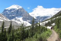
Climbing up toward the mountains. |
|
|

|
Its an impressive mountain! |
|
|

|
The rows of heaped gravel were left in recent decades as the glacier melted. |
|
|

|
Standing on the glacial moraine gravel, this is the view down the valley to Lake Louise. |
|
|

|
In mid-June at this altitude a few portions of the hiking path were still covered with snow. |
|
|
|
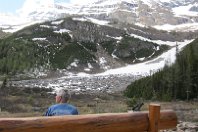
A comfortable bench for eating lunch and looking at the panorama of continental divide mountains. |
|
|

|
Mount Lefroy was off to our left. |
|
|

|
And Mount Victoria was off to our right. |
|
|

|
From time to time we heard what sounded like a gun shot. That was the beginning of an avalanche of snow falling from the upper slopes. This avalanche falling from the upper slope of Mt. Lefroy is the largest we saw. |
|
|

|
Snow continued to cascade down the cliff for a half minute. |
|
|

|
From the highest we walked on the moraine gravel, this is the view looking up into the gap between Mount Lefroy and the Mount Victoria ridge. The map says the top of the gap is called Abbot Pass and the narrow glacial slope up to the pass is called The Death Trap." Does that mean when climate warming melts the glacier, bodies will be found? |
|
|

|
Starting our descent down the moraine gravel. Soon after this photo was snapped, I was surprised to hear my cell phone ringing. Being surrounded by mountains I would have assumed that the phone wouldn't work, however, there must be a cell tower down near the hotel. My daughter was phoning to remind me that it was Father's Day. So I had a chat while seated on a stone among glacial gravel and surrounded by beautiful mountains. |
|
|

|
On the right is Mount Lefroy, on the left is Mount Aberdeen and in the center is The Mitre. The basin between them is Lefroy Glacier. |
|
|

|
Well hidden in the trees ahead, close to where we had earlier eaten our sandwiches, is a tea room. It was built in the 1920s and still operates without electricity or a road to bring in supplies. At an altitude 1200 feet higher than Lake Louise, everything is brought up in the backpacks of employees or via pack horse. |
|
|

|
We stopped for a cup of hot chocolate. It was delightfully relaxing on the narrow second floor porch. |
|
|

|
Continuing down the hill we came upon this rabbit on the path. |
|
|

|
Mount Lefroy in late afternoon. |
|
|

|
We took an alternate return path. It can be seen near the left edge of this picture crossing an open area and entering the woods. |
|
|

|
Through an opening on the wooded hillside we got this view looking down on the lake and the massive hotel. |
|
|

|
Early evening is not the optimal time to photograph Mirror Lake. |
|
|

|
The Big Beehive is a rock outcrop uphill from Mirror Lake. Again, the sun angle is not good for pictures. |
|
|

|
Back down near the hotel, this is the view looking up the lake at 8pm. Without sunlight the lake color is dark blue-green. Cloud is building over the upper peaks blocking the blue sky. We had climbed 2000 feet while walking 12.5 miles. |
|
|

|
In late evening, this photo was snapped from the Trans-Canada Highway of the moon above a mountain (that I haven't been able to identify). |