|
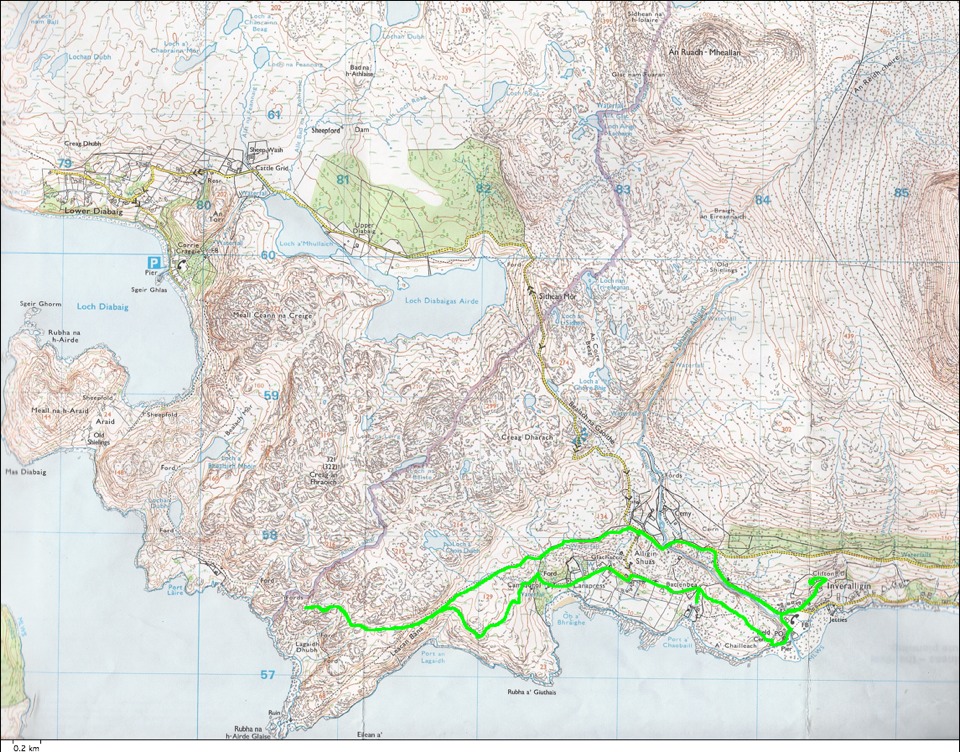
The route we walked on Sunday is shown in green along the bottom portion of this map. I first walked around the cottage so that the GPS receiver would record a square where the cottage is. Then we walked east out of the driveway and down the sloping road to the shore road and some of the houses of Inveralligin. We then walked to the mouth of the river, crossed it and walked across relatively flat open land to another scattering of houses called Alligin Shuas. We then walked out onto one then another rugged peninsula with great views up Loch Torridon. Our return walk stayed on higher ground and reached the road (a narrow Highland single-track road with passing places every hundred yards or so). A stone bridge crossed the deep gorge of the river. We turned downhill on the road entering Inveralligin, and went on up the hill to the cottage.
|
|