| <-- Previous | ^ Up ^ | Next --> |
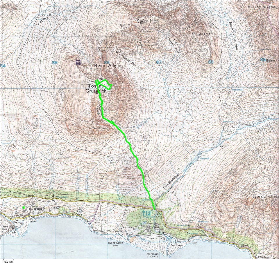
| This map shows the route walked in green. It is nearly straight from the road where we left the car to the top of the Tom na Gruagaich peak of Ben Alligin. The altitude difference is nearly 3000 feet and the distance is only two miles to the top. It is one of the most constant gradient hills we have walked. The cottage where we stayed is identified by the small green square near the lower left corner of this map. |