| <-- Previous | ^ Up ^ | Next --> |
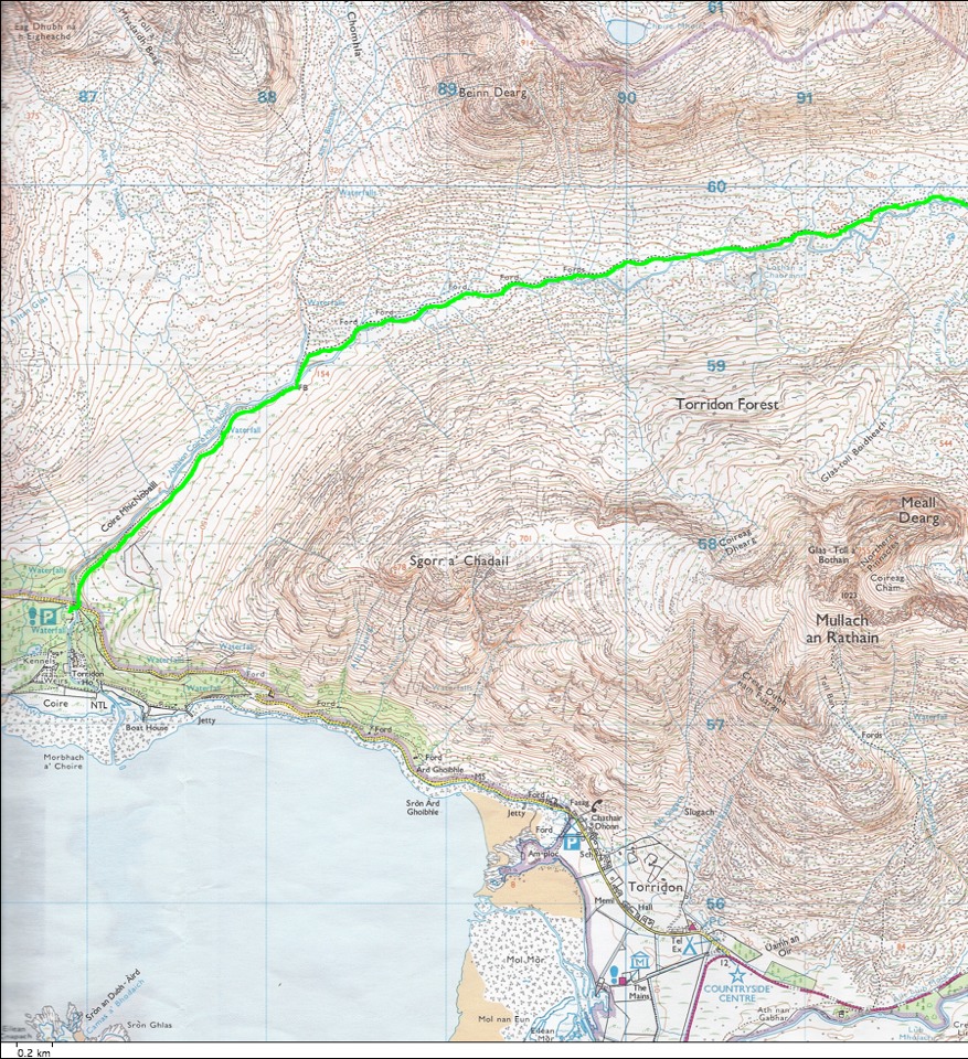
| The walk was too long to fit onto one scanned map image. This map shows the first half of our route. From the road in the wooded area, we followed the stream to the northeast and continued around until we were heading east. The village of Torridon is near the highway junction at the bottom of this photo. |