But before leaving the upper slope east of the Clyde, this photo was taken looking back into the valley.
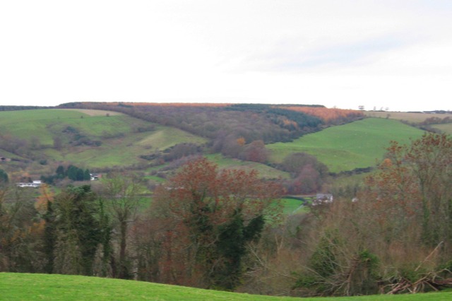
On the other side of the valley, the old road junction in the saddle between Lockhart's Knowe and the main hillside is at the center of this picture. The route from the hilltop beside the motorway past Draffan Burn comes through that thickly wooded area on the upper slope of the valley. The route of the eighteenth century road is along the lower edge of the woods and slopes down to the houses near the left edge of the picture. The old driveway down to Threepwood Farm is the line of trees that starts down to the right, just this side of Lockhart's Knowe, and then turns toward the cluster of farm buildings visible just above the foreground trees.
|
|