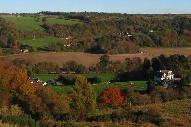
This picture was taken from high on the west side of the valley to show the pertinent spots on the floor of the valley and up the east slope.
All across the center of the picture, the brown field is the 80-acre field. The river is in the line of trees just this side of the brown field. The steep sides of Poplar Hill, just beyond the brown field, are fairly clear in this picture. The plausible route up the hillside is from the lower green field near the left side of this picture, then behind Poplar Hill, then the U-turn around the houses, then angling up the steep wooded hillside to the upper green field just left of the center of this picture.
|
|