Torridon in September 2009
|
Back to home page
|
We spent seven nights and six days in the Torridon area of northwest Scotland.
Below are some pictures with a narrative beside each one. Click on an image below to see a larger version of the picture. When viewing a larger picture, clicking "Next" allows you to look at the larger pictures one at a time.
|

|
Torridon is a rather remote section of Scotland. This photo shows Upper Loch Torridon, a tidal finger of the sea. To get there one drives west from Inverness on successively smaller and slower roads until one arrives on a single-track road at the head of the loch, in the left-center of this picture. The loch is surrounded by hills that reach altitudes of over 3000 feet. Four of us stayed in a cottage for a week in September 2009. Four of the six days we were there, we walked along the coast or among the hills. One day was very stormy and we stayed in the cottage all day. One day we went on a driving tour to Plockton and Applecross. Most nights we ate in restaurants serving fresh local seafood.
|
|

|
The cottage was built in the 1970s by a Glasgow couple as a retirement home. They had an active retirement here for 20 years. They planted extensively around the cottage, including fruit trees and vines and a vegetable garden. They hill walked extensively and were active in the Torridon Mountain Rescue group. Due to health issues, they had to move to a less remote location. The man died a few years ago and the lady is still alert in her upper 90s.
|
|

|
From a bit higher on the hill behind the cottage, this is the view of the loch and the hills to the southwest. The cottage is on a flat shelf of land at an altitude of about 115 feet above the high tide level of Loch Torridon. The green area down near the water is the Inveralligin common ground, just this side of the mouth of the river.
|
|

|
This view is looking southeast, toward the sun, from the hill behind the cottage (visible in the lower right corner).
|
|

|
On Sunday we set out from the cottage to walk westward, along paths that roughly follow the shore of the loch. The cottage we stayed in is hidden by trees, in the left-center of this photo. This village is called Inveralligin, because it is at the mouth of the Alligin Water (a small river that flowed about 50 feet behind where I was standing to take this picture). The plants in the foreground are potatoes. The hill behind the village, with cloud covering the top, is Ben Alligin, which is 3000 feet high.
|
|

|
There isn't much flat land in the Torridon area, but the path we were following crossed this rather flat area, which the natives once used to grow crops, such as potatoes. It wasn't very productive soil. The people collected kelp from the high tide line and carried it up to fertilize the crops. The cottage where we were staying is visible in the center of this picture, on the other side of the Alligin Water.
|
|

|
This photo is taken at the same spot, looking eastward toward the ridge called Liathach, which includes several peaks over 3000 feet in altitude. Near the right edge of this photo is the head of Upper Loch Torridon and the village of Torridon.
|
|
|
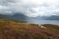
We walked down through a scattering of houses called Alligin Shuas and up onto this headland. I like this view of Loch Torridon with some sunshine and heather in the foreground. Liathach is in the left-center of this view.
|
|

|
This view to the southeast is of the hills south of Loch Torridon.
|
|

|
The path through the heather is taking us toward the next headland
|
|

|
Another view of the heather on the hillside.
|
|

|
The path through the heather.
|
|

|
We had lunch here. We sat on a rock and looked down the slopes to the loch and at the hills in all directions. We are wearing our waterproof jackets because we had a brief passing shower earlier and it was breezy.
|
|

|
We turned back before we got to the village of Diabaig. On the way back I noticed that there was no cloud covering the top of Ben Alligin, as there had been earlier.
|
|

|
The route we walked on Sunday is shown in green along the bottom portion of this map. I first walked around the cottage so that the GPS receiver would record a square where the cottage is. Then we walked east out of the driveway and down the sloping road to the shore road and some of the houses of Inveralligin. We then walked to the mouth of the river, crossed it and walked across relatively flat open land to another scattering of houses called Alligin Shuas. We then walked out onto one then another rugged peninsula with great views up Loch Torridon. Our return walk stayed on higher ground and reached the road (a narrow Highland single-track road with passing places every hundred yards or so). A stone bridge crossed the deep gorge of the river. We turned downhill on the road entering Inveralligin, and went on up the hill to the cottage.
|
|

|
Beyond Diabaig there is about seven miles of uninhabited road-less coast accessible only via walking path. On Monday we drove for an hour to get to the end of the road at the other side of that road-less gap. The map showed a couple of beaches there, on either side of the Red Point headland. The other motive is that we had heard of a good seafood restaurant near there on the road back to the our cottage. This photo was taken at the lookout point above the beach north of Red Point.
|
|

|
This photo was taken at the same spot. I'm not certain, but the distant hills seen on the right side of this picture may be part of the Cuillins on the Isle of Skye, about 30 miles away.
|
|

|
This is the beach south of Red Point. The distant land in this picture is the northeast peninsula of the Isle of Skye, about 15 miles away. The clothing worn is due to the wind blowing off the sea.
|
|

|
This is another view of the hills on Skye, in this case taken from the grass covered dunes behind the beach.
|
|

|
For lunch we each picked a rock to sit on. The view is of outer Loch Torridon in the foreground. The nearest land in the distance is probably (I'm not sure of the angle of this picture) the low-lying peninsula that forms the south shore of Loch Torridon.
|
|

|
Rather than walk on the muddy path closer to the shoreline, at times we walked through the grass and heather.
|
|

|
Crossing a burn by jumping from one rock to the next.
|
|

|
After we turned back, this photo shows the coastal path back toward the Red Point beach visible in the upper left. In most places the coastal path was simply where people had walked. It had not benefitted from much effort to improve the path.
|
|

|
Here, with a clump of heather beside the path, a few stepping stones had been placed to help walkers across a muddy spot.
|
|

|
The route we walked is shown in green. We started at the parking area near the top left corner, walked through a farm, then along the beach and then along the rocky coast.
|
|
|
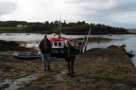
We had a seafood dinner at the restaurant beside this small harbor in Badachro on Loch Gairloch.
|
|

|
Another view of the fishing port.
|
|

|
This is the view looking up the burn that flows into the sea right beside the fishing port jetty. This photo and the preceding two photos were all taken within 50 feet of each other.
|
|

|
When I saw this shed with a Bed and Breakfast sign, it appeared to be the smallest and most rustic B&B I had ever seen. It was about six feet wide and eight feet long, which would seem to be just enough room for a bed. I laughed, took this picture and commented to one of my traveling companion that it was "The most basic B&B I'd seen." A local person overheard me and commented to his companion that he had never noticed that the sign did not say that it was actually advertising a B&B elsewhere in the village.
|
|

|
On Tuesday we drove to Plockton, a picturesque village on Loch Carron. Plockton is only 15 miles south of Inveralligin, but it was a 90-minute scenic circuitous drive to get there. The popular tourist sites of Eilean Donan Castle and the bridge to the Isle of Skye are only 10 to 20 minutes beyond Plockton. We had lunch in the Plockton Hotel. The scallops were excellent.
|
|

|
Yes, there are palm trees growing along the shore in Plockton. The land and water apparently provide enough protection for tropical plants. The blue sky at the time this photo was snapped is in contrast to the rain we experienced at the same spot an hour earlier.
|
|

|
The anchored small boats, the cluster of buildings with the substantial hill beyond the loch make a nice picture, for my eye anyway.
|
|

|
As we were leaving Plockton, these sheep held up traffic while they ambled down the road. They finally wandered over to the grass to let traffic move onward on the single-track road. We drove half way back toward Loch Torridon and then turned left onto a narrow road that went over high hills to get to Applecross. We explored, to the degree possible by car, the entire Applecross peninsula. It is a remote area that isn't easily accessed. We followed the shore road northward until we were on the south shore of Loch Torridon.
|
|

|
In Applecross we passed a large herd of deer grazing in a field. We weren't sure whether they were wild or being raised for venison.
|
|

|
Wednesday there was a howling gale blowing off of the sea all day. We stayed indoors, talking, reading, playing games and eating.
On Thursday two of us walked up Ben Alligin. There is car parking where the road crosses the burn. The excellent path quickly emerges from the trees and heads up the open slope.
|
|

|
Except for the low-hanging clouds, which we experienced all week, the weather was excellent for hillwalking -- no rain, relatively light wind with temperatures in the 50s. We wished for some blue sky, but alas few days in the Highlands are perfect.
|
|

|
About half way up the hill, the path approached this immense hollow, or corrie, in the side of the hill. It was formed by a heavy glacier which carved this deep gash in the otherwise rather symmetrical hill.
|
|

|
This photo was snapped eight minutes later, with less camera zoom, at a moment when the cloud had lifted from the top of the hill.
|
|
|
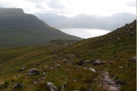
This is the view looking down the path to the southeast. The hill on the left is the west end of Liathach. The east end of Upper Loch Torridon and the hills beyond are partially shrouded in mist.
|
|

|
From the same spot, this is the view looking east. Liathach is the ridge on the right. On the left is Ben Dearg and in the distance, at the top of the glen, is the west end of the Ben Eighe ridge. It is up that glen between those hills that we walked the next day.
|
|

|
The walk up through the huge corrie was in several ways the most delightful Munro (hill over 3000 feet altitude) we have ascended. The gradient of the slope was constant. No clamoring over rocks was necessary. It was like walking up constant-gradient stairway in fresh air. Being in a deep gully, it was sheltered from the wind. And, best of all, beside the path there was a delightful small burn (stream) falling over countless waterfalls.
|
|

|
This was the largest waterfall. The deep green is moss beside the water. The upper waterfall split into three or four streams of water.
|
|

|
The stepping-stone nature of the path is more clear in this photo as we are approaching the cloud near the top.
|
|

|
At the same spot, this is the view down through the corrie, with Upper Loch Torridon in the mist below.
|
|

|
Lunch near the top. The cloud was high enough at that moment to see Upper Loch Torridon and, beyond it to the south, Loch Damh.
|
|

|
Ben Alligin is a crescent shaped ridge. The peak we were on is called Tom na Gruagaich. The other high peak along the ridge is Sgurr Mor, with cloud on the top in this picture. It seems that most serious walkers ascend Sgurr Mor, then cross the ridge to this peak (the path is visible near the left edge of this photo) and then descend through the corrie back to the car park. But on that day, we were quite content with just going up and down one hill.
|
|

|
This is the cairn on the highest point on Tom na Gruagaich. Note that the cloud has blotted out all views. We walked around the relatively flat top looking for a gap in the clouds through which photos could be taken, but none appeared while we were on top.
|
|

|
As we started our descent, Upper Loch Torridon again became visible beneath the cloud.
|
|

|
The waterfalls were delightful beside the path.
|
|

|
This view is looking back up the corrie. The waterfall in the previous picture is in the distance in the center of this picture.
|
|

|
As we emerged from the glacial corrie, Sgurr Mor came into view, along with the rugged hills at the east end of the Ben Alligin ridge.
|
|

|
Looking back at the glacial corrie we had just descended.
|
|

|
With the cloud somewhat lifted the view up the glen to the east is clearer. At the top of that glen, at the center of this picture, is the west end of the Ben Eighe ridge.
|
|

|
From the same spot, this is the view to the southeast of the hills beyond Upper Loch Torridon.
|
|

|
The lack of color in this picture is due to snapping a photo looking southwest toward the sun. A small portion of Inveralligin is visible on the shore of the Loch. On the other side of the loch, the seven things in a row are floating fish farm cages.
|
|

|
This map shows the route walked in green. It is nearly straight from the road where we left the car to the top of the Tom na Gruagaich peak of Ben Alligin. The altitude difference is nearly 3000 feet and the distance is only two miles to the top. It is one of the most constant gradient hills we have walked. The cottage where we stayed is identified by the small green square near the lower left corner of this map.
|
|

|
On Friday, our last day in the Torridon area, all four of us walked around the Liathach ridge . We left one car beside the main road at the Glen Torridon end of Liathach and started our walk at the base of Ben Alligin, at the same car park as we had used the previous day. This waterfall is visible from the road bridge.
|
|

|
Initially the excellent path along the east side of the stream is through a wooded area. On the left, with the red berries, is a rowan tree.
|
|

|
The heather beside the path adds nice color to the photos.
|
|

|
After we left the protection of the trees, we didn't see heather as lush.
|
|

|
The rest of the day we walked in open moorland, usually with clouds covering the tops of the higher hills. The path was in excellent condition on the first third and last third of the walk. The middle third, the furthest from the roads, was largely unimproved, except for well placed stepping stones where the route crossed a burn. Unlike the path shown in this picture, we experienced quite a few muddy sections along that middle portion of the walk.
|
|

|
The Gaelic name on the map suggests that this glen was known as the valley of the MacNoble clan. Coire Mhic Nobaill appears to mean the hollow of the MacNobles, while Abhainn Coire Mhic Nobaill seems to mean the stream that flows through the valley of Clan MacNoble.
|
|

|
We all went over to the edge of the ravine to see the waterfall flowing into the stream. That is the burn we walked beside the previous day in the Ben Alligin Corrie.
|
|

|
Clearly someone has said something funny. However, as we are writing these photo captions months later, we can't remember what was said.
|
|

|
We had seen several rowen trees in the wooded area back near the road, but here was a lone rowen tree growing beside the stream. That is the Tom na Gruagaich peak of Ben Alligin in the background, as was usual that week, with cloud covering the top.
|
|

|
This view is looking back down the path with the small rowan tree and a clump of heather beside the path. Just above this point there was a fork in the stream. We crossed on a footbridge and followed the eastern branch of the stream.
|
|

|
Looking eastward with the path near the stream.
|
|

|
Looking up at the imposing slopes of Ben Dearg to the north of us as we are walking eastward.
|
|
|
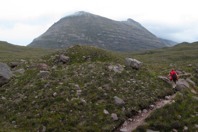
As we got further east, between Liathach on our right, Ben Dearg on our left and Ben Eighe ahead of us, we saw the evidence left by the glaciers that carved this landscape. In the foreground of this photo is a mound of rock and soil dumped by a melting glacier.
|
|

|
We each picked convenient rocks for our lunchtime chairs. After lunch some studied the route ahead visually while others studied the map.
|
|

|
Then among the mounds of rocks dropped by the glaciers, there were also quite a few small lochans (ponds). Ahead is the target we have been walking toward for several hours, the west end of the Ben Eighe ridge.
|
|

|
Here, with Ben Eighe on our left and Liathach on our right, we are descending along a well maintained path.
|
|

|
On the final descent, the highway from Inverness to Loch Torridon crosses from left to right in this photo. The car is parked just out of sight on the right.
|
|

|
The walk was too long to fit onto one scanned map image. This map shows the first half of our route. From the road in the wooded area, we followed the stream to the northeast and continued around until we were heading east. The village of Torridon is near the highway junction at the bottom of this photo.
|
|

|
This map shows the second half of the route we followed.
|
|

|
In the village of Torridon there is this nineteenth century open air church. It's actually on a small island that is a peninsula except in very high tides. There was a division in the church. The congregation that separated did not have a church building, so they set up these stone pews.
|
|

|
The preacher had a wooden shelter, to keep his bible dry, up on the top and lectured at the worshipers sitting out in the open weather. The people were protected only by the rocks from west winds coming up the loch and were totally unprotected from east winds coming down Glen Torridon at their back.
|
|

|
This is the view from the front window of the cottage of the hills across the loch to the southeast.
|
|

|
This is the cottage view to the southwest.
|
|

|
I went out onto the lawn to capture the setting sun and the small clouds that seemed to be playing with the hills on the other side of the loch.
|
|

|
This photo was snapped a few minutes later using more camera zoom. The constantly changing clouds were just rolling over and around the peaks of those hills.
|
|

|
We drove around the loch to have dinner in Shieldaig. The sun had set behind a wooded island in the loch.
|
|

|
We all enjoyed our fresh seafood evening meal.
|
|

|
The right-center portion of this map shows the Loch Torridon area of Wester Ross. The bridge to the Isle of Skye is at the Kyle of Lochalsh, at the bottom of this map. A few miles north of there is Plockton, where we had lunch one day. The Applecross peninsula is northwest of Plockton and south of Loch Torridon. The route of our four Torridon walks is plotted in light green. We hope we get to return to Torridon to walk other hills and glens, for the excellent seafood dinners and for the unspoiled scenery.
|
|
|
|
Back to home page
|