West Highland Way Photos
Back to West Highland Way pageBack to Bill's home page
Walking the West Highland Way was a memorable experience. We are sharing some photos with a narrative in the captions beneath each photo. We walked for nine days but only had rain during a portion of one day, in the glen and forest approaching Fort William.
Click on a two-inch image below to see a six-inch version of the picture. When viewing a six-inch picture, clicking "Next" allows you to look at the six-inch pictures one at a time. There is one panoramic image that can be viewed by clicking "Larger Version." However none of these images are of sufficient resolution for a quality print. If you would like a higher resolution printable picture, please let me know.

Our limbering up first walk was 9 miles from the Drymen car park to the B&B in Balmaha. We set out by going east along Stirling Road to join the West Highland Way. We enjoyed some wild raspberries, brambles (blackberries) and blueberries along the first portion of the path. We had lunch after emerging from the forest northwest of Drymen. On the rising slope of Conic Hill we enjoyed the blooming heather and the increasing vistas towards the Highlands and Loch Lomond. The weather was warm and bright.
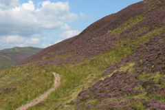
Heather beside the walking path. This view is on the upper slope of Conic Hill looking back along the path we had walked.
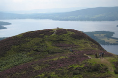
From the highest of several bumps on Conic Hill looking down at the lower portion of Loch Lomond.

In the sun appreciating the broad vistas to the south.

Descending past rowan trees full of bright berries.

It rained overnight as well as during breakfast, so we suited up for a wet day. We walked from Balmaha to Inversnaid, a distance of 17.5 miles according to the GPS receiver.

A Loch Lomond island in the fog.
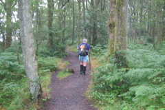
We didn't experience any rain and it was warm so we didn't stay in wet weather gear long.

As the fog lifted, the beauty of Loch Lomond emerged.

The day became bright by the time 3200-feet-high Ben Lomond appeared ahead. The West Highland Way goes along the lochside to the left of Ben Lomond.

A Loch Lomond beach beside the West Highland Way.

The sisters were caught skipping down the path.
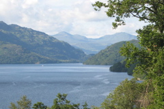
Another view of scenic Loch Lomond.

From the path along the east side of Loch Lomond, that's Ben Vorlich on the other side of the loch.

Barry celebrated his birthday that evening at Inversnaid Lodge.

The view from our Inversnaid Lodge bedroom window the next morning. The cloud is lifting from the hills across Loch Lomond.
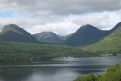
The view across Loch Lomond from the road between Inversnaid Lodge and the lochside.
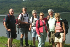
On the bonnie banks of Loch Lomond ready to set off up the next leg of the West Highland Way. The walk from Inversnaid Lodge to Beinglas was 8.2 miles.

There were a lot of casual strollers from Inversnaid Hotel. This photo of a lady in a pleated skirt with a gold handbag walking up the rough rocks and roots is included as a reminder of the photo that I missed a couple of minutes earlier. There were three ladies with large backsides trying to get up a rocky portion of the path. One lady had reached the top of the boulder, the second lady was part way up and the third lady was on the path below. The first lady was trying to pull the next lady up and the third lady was trying to help too. I regret not having my camera ready. Some images can only be recorded in one's mind. The third lady was pushing with her two hands firmly planted on each cheek of the large bottom of the lady above her. But they saw us before I got my camera ready. As we went past them one of the ladies said "You have better shoes for this." as if their difficulty with the rocky path was fully explained by inadequate footwear.

This is a nearly ideal image of walking the West Highland Way. The deep blue of the sky, the white puffy clouds, the clarity of the hills ten miles away, the green along the lochshore hills, the island, the sunshine on the path and the green beside the path all seem to frame the walker. Even the recently mowed bracken beside the path seems to add color. That was the only mowing I remember along the West Highland Way.

Lunch on the beach, with a view!
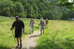
After lunch everyone is off up the path away from the loch shore.

Leaving Loch Lomond behind and heading into Glen Falloch.
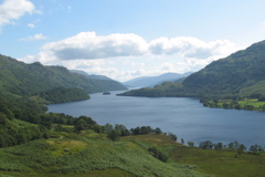
From a hill we get a last view of Loch Lomond to the south. Before lunch we had walked the portion of the east shore of the loch shown on the left side of this photo.

This is another last photo looking south, back down Loch Lomond.
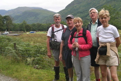
On the fourth morning, as we departed Beinglas, the sky isn't as bright as it was the previous day. The walk from Beinglas to Ewich House, a bit beyond Crianlarich, was 9.0 miles.

The girls were caught skipping across the River Falloch bridge.

This view looks down Glen Falloch along the route we had walked. The sky remained grey all morning but brightened in the afternoon.
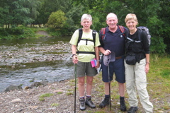
On the fifth morning the sisters and cousin beside the River Fillan, near the remains of St. Fillan's Priory. The walk from Ewich House to the Inveroran Hotel was 13.8 miles.
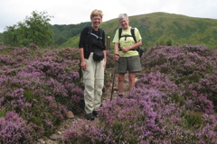
Two walkers pause along the path for a photo. An example of a West Highland Way marker post is visible behind the walkers.
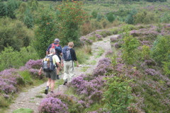
The path passes through heather in Strath Fillan, with a rowan tree ahead.

No where else have I seen a convenience store that promotes foot-care. And this Tyndrum shop has a warning facing directly at passing West Highland Way walkers that it is 28 miles to the next store.

Most of the path is along a road built about 250 years ago to allow the British Army quick access to the Highlands if the Highlanders should rebel again. Since the bottom of the glen is boggy the road was built along the side of the hill. The wall along the road has fallen away in some places but the road is still used by farm equipment. This photo is looking up the glen down which we have walked.
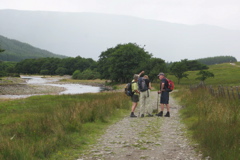
They are probably discussing the content of the guide book or map. But they may be expressing thoughts on the next wave of misty moisture that is rolling up the glen. We experienced three or four misty waves that afternoon.
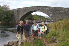
The Bridge of Orchy carries the eighteenth century military road over the River Orchy and still carries local vehicle traffic as well as the West Highland Way.

On the 250-year-old bridge looking at the back of the Bridge of Orchy Hotel on the main highway. Beyond the hotel to the east is 3500-foot-high Ben Dorain with cloud on the top.

I liked the old stone arch bridge and thought it would be a good photo if I could use the arch to frame the hill to the south, Ben Bhreac-liath. I needed to cross about six feet of the river on stepping stones to get to a large stone ledge. I slipped and my left leg went into the river. After I snapped this photo, I noticed that my knee was bleeding (the only wound during the whole week).
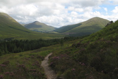
This photo is looking back at the glen we have walked down during the previous hours.

Descending toward the isolated Inveroran Hotel. The nearly trackless hills in the background extend westward for 20 miles.

Ready to depart on the sixth day for our 9.9 mile walk to Kings House. We have all covered ourselves with insect repellent, as clouds of midges appeared early and late each day. Note the date of the hotel.

Another nice day for walking.
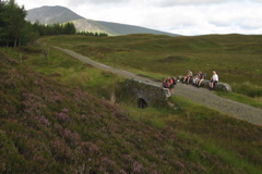
A nice quiet place for lunch. But the midges swarmed so we didn't stay long.
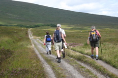
This was a day of long straight paths across moorland. The road was built by Thomas Telford about 200 years ago. He was Britain's most famous civil engineer of the era. Telford was commissioned to replace or repair the military roads built 50 years earlier. This one was in use as a vehicle road until 1933.

It's snack time beside the moorland path.

This is a panoramic composite photo of Rannoch Moor from north to south.

On Rannoch Moor. There is heather in the foreground and the foreboding hills on the approaches to Glencoe are in the background.
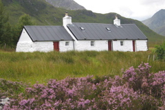
A picturesque Highland cottage with heather in the foreground.

The white Highland cottage with Buachaille Etive Mor, at the top of Glencoe, behind it.

Raspberries have again been spotted beside the path, so everyone is having some fruit. Through the gap in the distance is Glencoe.

On the seventh morning we are off on our 11-mile walk from Kings House to Mamore Lodge beyond Kinlochleven. This view is looking back toward Kings House about a half mile behind us. The vastness of Rannoch Moor is evident. The modern highway can be seen crossing the River Etive and then out across Rannoch Moor. The previous day we crossed the Moor along the right side of this photo. The day prior to that we had walked among the hills on the horizon.

This view is towards Glencoe.
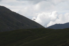
The RAF was flying at low level through several glens in the area. I finally had my camera ready enough to capture this jet flying away from us.

There was a feeling of accomplishment as we reached the highest ridge we would cross on the West Highland Way, an altitude of 1800 feet. We had that morning ascended half of that height, and that afternoon we descended to sea level at Kinlochleven.

These resourceful people prepared lunch of smoked salmon on buttered oat cakes with lemon juice and pepper sprinkled on top and served on paper plates. The Mamore Hills are in the background.
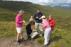
The three ladies laughed a lot while mothering the two German lads we had met several times in recent days.
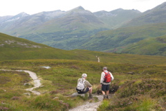
The length of the descent toward Kinlochleven isn't fully evident in this photo. Mamore Lodge is one of the two white dots in the trees on the distant hill beyond Kinlochleven. We stopped at a Kinlochleven pub for a freshly baked scone with butter and jam, before setting off on the tedious climb to Mamore Lodge.

On the eighth morning we set out from Mamore Lodge for Fort William, which turned out to be a 16.5 mile walk. The fact that Kinlochleven was barely visible behind the walkers set the tone for the weather that day.

This is another view looking westward down Loch Leven. The low clouds told us it was going to be a dull day.

The first stretch was along the eighteenth century military road up the green glen. At this point it hadn't rained yet.
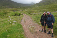
By the time we are going down the next glen, we have all put on our waterproof jackets. When the next wave of rain started we all put on waterproof trousers as well
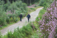
After several hours of on and off rain these two cousins were having fun and eating brambles (blackberries) along the path lined with heather on one side and fireweed on the other.

Carrying bouquets of heather to Fort William.
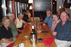
In Fort William we are all seated in the seafood restaurant on a Loch Linnhe pier awaiting our celebratory meal. Barry isn't really asleep.
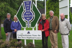
Since we had the previous evening made our way one or two at a time to the hotel, we gathered the next morning for photos at the official end point of the West Highland Way.
Two days later, two of us were able to walk the first leg from Milngavie to Drymen. Unfortunately, my camera memory chip didn't properly record the photos taken that day. The weather was good and it was a rather flat 12.4 mile walk, in some places along the route of a former railway.
By the way, the blue background on this web page is a photo of a Scottish sky.
Back to West Highland Way page
Back to Bill's home page